.gif)
.jpg)
Introduction
Sometimes a data requirement is deliberately simple. You do not need menus, reviews or offers. You need to know where restaurants are and what kind of food they serve. A restaurant list with cuisine and address is the foundation for many projects: market mapping, franchise planning, supplier targeting, delivery-zone analysis and academic studies. The challenge is that this simple dataset must be accurate and complete across thousands of outlets. For businesses planning restaurant data scraping in India, this information provides a practical starting point for building a reliable city-level dataset.
This article explains how restaurant cuisine and address data is scraped from Zomato, Swiggy and Google Maps, how the sources complement each other, how to clean and standardise cuisine labels and addresses, and how to use the result.
Why Cuisine And Address Matter
Cuisine tells you what a restaurant sells, and address tells you where. Together they let you:
- Count restaurants per cuisine per locality
- Spot areas where a cuisine is under-served
- Plan new outlets and cloud-kitchen locations
- Target suppliers who match each cuisine's ingredients
- Study food trends by region and demographic
The Three Sources And Their Roles
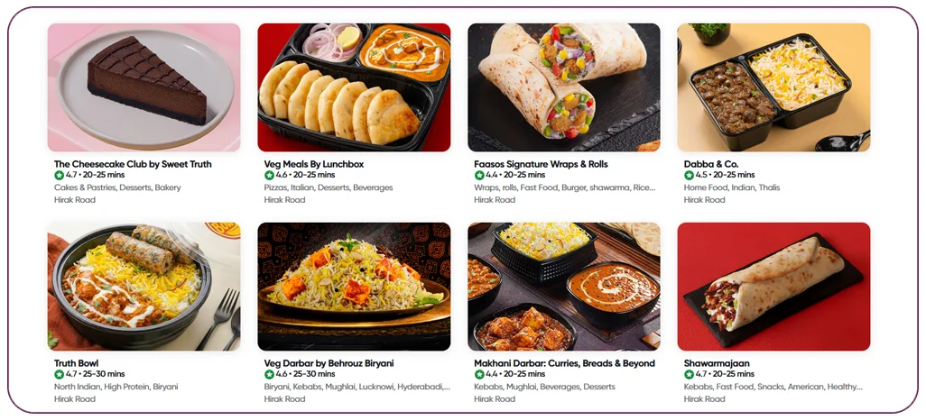
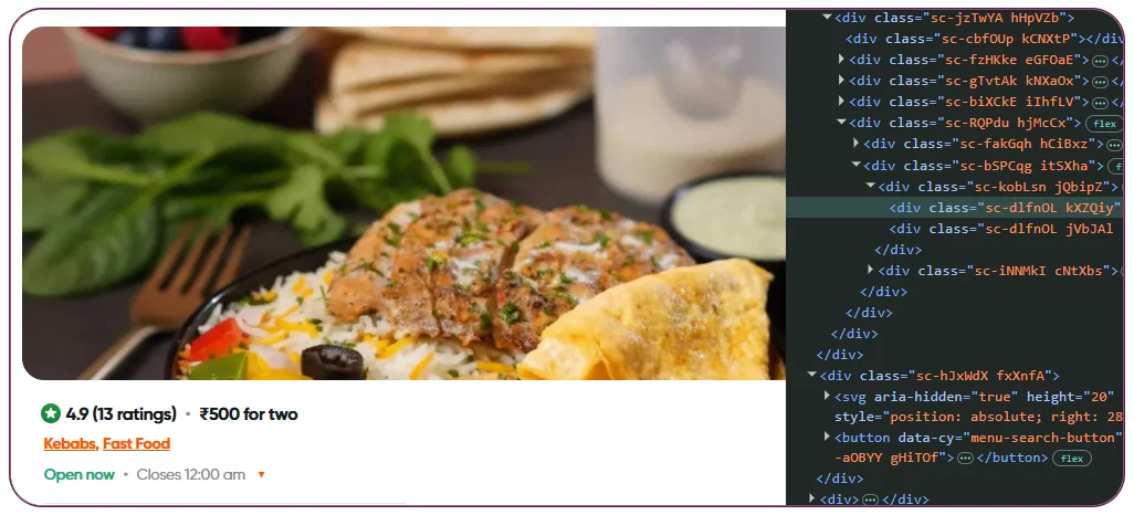
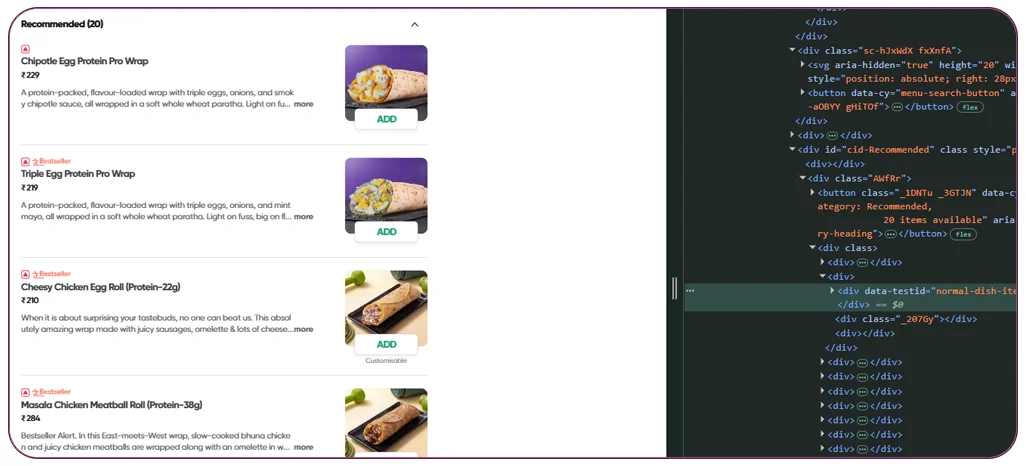
Zomato typically provides cuisine tags, price-for-two, rating, address and locality, and whether the outlet offers dine-in or delivery. Cuisine labels are often detailed and multi-valued, such as North Indian, Chinese and Biryani. A well-configured Zomato scraper can collect these cuisine and outlet details in a consistent format for further analysis.
Swiggy focuses on delivery outlets and shows cuisines, ratings and delivery areas. It is especially useful for cloud kitchens, which may not have a public dining address. A Swiggy scraper is useful when the focus is on delivery coverage, including cloud kitchens and serviceable areas.
Google Maps provides the physical address, coordinates, category, phone number and hours, and it covers outlets that are not on any food app. Its categories are broader, such as Indian restaurant or Fast food restaurant, so it is less detailed than the food apps on cuisine. Combining Google Maps Restaurant Data with food-app listings helps verify physical locations and improve address coverage.
Using all three gives the best coverage and lets you cross-check each outlet.
Data Fields To Extract
- Restaurant name and brand name
- Cuisine tags as shown on each platform
- Standardised cuisine categories (created during cleaning)
- Full address, building, street, locality, city, state and pincode
- Latitude and longitude
- Phone number where publicly listed
- Price band or price-for-two
- Rating and review count
- Dine-in, delivery or both
- Opening hours
- Source and last-updated date
Step-By-Step Scraping Workflow
- Define the geography. City, localities or a map polygon. For large cities, break the area into smaller zones.
- Collect restaurant lists. For each platform, set the location and page through the restaurant list, including all collections and sorting options so that no outlet is missed.
- Open restaurant pages. Extract cuisine tags, address and other details. This cuisine data extraction step helps preserve the original platform labels while creating consistent categories for analysis.
- Geocode where necessary. If an address has no coordinates, convert it to latitude and longitude.
- Standardise cuisines. Map platform-specific tags into a controlled list.
- Standardise addresses. Split into components, fix abbreviations and add pincodes.
- Match and merge. Combine records for the same outlet across platforms.
- Quality check and deliver. Remove duplicates and closed outlets, then deliver as a file or API. For structured food datasets, explore the Food Data Scraping API.
Cleaning Cuisine Labels
Cuisine data looks simple but is messy. Platforms use different words for the same thing, and one outlet may carry five tags. A practical approach is to create two levels:
- Primary cuisine: one main category such as North Indian, South Indian, Chinese, Italian, Fast Food, Bakery, Desserts, Beverages or Biryani
- Secondary tags: all other tags kept in a list
Rules decide the primary cuisine, for example by choosing the first tag or the one with the strongest weight. Synonyms are merged, such as Indian and North Indian when the platform means the same thing, and cloud-kitchen brand names are mapped to the cuisines they serve.
Cleaning Addresses
Indian addresses vary widely in format. Common issues include missing pincodes, landmark-based addresses, inconsistent abbreviations and mixed languages. Good practice includes: Accurate restaurant address data is especially important when records will be used for mapping, distance calculations or locality-level analysis.
- Splitting the address into building, street, locality, city, state and pincode
- Standardising abbreviations such as Rd, Nr and Opp
- Validating pincodes against locality
- Geocoding to coordinates for mapping and distance-based matching
- Keeping the original address text next to the cleaned version
Matching Outlets Across Platforms
The same restaurant often appears with slightly different names and addresses on each platform. To match them, combine name similarity, address similarity and geographic distance. For example, two records within 50 metres with similar names and the same phone number are almost certainly the same outlet. Borderline matches should be flagged for manual review, not forced.
Technical Challenges
- Dynamic listing pages: restaurant lists load as users scroll, so scraping must continue until no more results appear.
- Location-based results: platforms show different outlets depending on the delivery location, so many locations must be sampled to cover a city.
- Hidden addresses for cloud kitchens: some delivery-only outlets show only an area name.
- Scale: a large city can have tens of thousands of outlets. Scheduling and storage need to be planned.
- Frequent changes: restaurants open, close and rebrand constantly, so datasets age quickly.
Use Cases
- Market mapping: count and visualise restaurants by cuisine and locality.
- Franchise and expansion planning: identify white-space areas for a new concept.
- Supplier prospecting: target restaurants by cuisine for ingredients, packaging or equipment.
- Delivery and logistics planning: model demand zones and rider coverage.
- Academic and policy research: study food environments, accessibility and diversity.
Example: A Regional Cuisine Gap Analysis
A restaurant group wants to launch a South Indian quick-service brand in Mumbai. It scrapes restaurants from Zomato, Swiggy and Google Maps across 40 localities and standardises cuisines. The analysis shows that some suburbs have many South Indian outlets while others, with similar population density, have very few. The group shortlists three under-served localities for pilot stores and uses the data to estimate competition.
Sample Output
A delivered row includes: unified ID, restaurant name, primary cuisine, secondary cuisines, address, locality, city, pincode, latitude, longitude, phone, price band, rating, review count, delivery or dine-in flag, source platforms, source URLs and last-updated date.
Delivery And Refresh
The dataset can be delivered as CSV or Excel, as a JSON API or loaded into GIS tools for mapping. Quarterly refresh suits market studies, and monthly refresh suits sales and supplier use.
Responsible Scraping
Collect only publicly visible business information, avoid personal data, keep request rates reasonable and review platform terms and applicable laws.
Why Choose Real Data Api For Restaurant Data Scraping
Real Data API builds scrapers for Zomato, Swiggy and Google Maps, standardises cuisines and addresses and matches outlets across platforms into one clean list. A pilot for one city shows coverage and accuracy before you scale to more cities.
Conclusion
Restaurant cuisine and address data scraping looks simple but depends on careful cleaning, geocoding and matching. By combining Zomato, Swiggy and Google Maps, you can build an accurate, map-ready list that supports market analysis, sales prospecting and expansion planning.
Need restaurant cuisine and address data? Real Data API can deliver a pilot for your city.
FAQs
1. Can I get only restaurants and not cafes or bakeries?
Yes. Filters by category or cuisine can limit the output to the types you need.
2. How many restaurants can you cover in a city?
The number depends on listings. Large cities can have tens of thousands of outlets. A pilot gives an exact count.
3. Can you provide coordinates?
Yes. Coordinates come from the source where available or from geocoding the address.
4. How do you handle outlets that appear on only one platform?
They are kept with a lower confidence score and a source flag.
5. Can the data be mapped?
Yes. Coordinates make it easy to visualise in GIS or dashboard tools.
Latest posts
Hotel & Restaurant Supplier Data from Google Maps, Zomato, Swiggy and FoSCoS
How to Overcome Inaccurate Travel Fare Estimates with Rome2Rio Travel Data Scraping API for Route Comparison
How to Solve Inaccurate Wine Matching with Vivino API for wine recommendation data

How to Solve Anime Streaming Metadata Issues with HiAnime API integration


.png)


